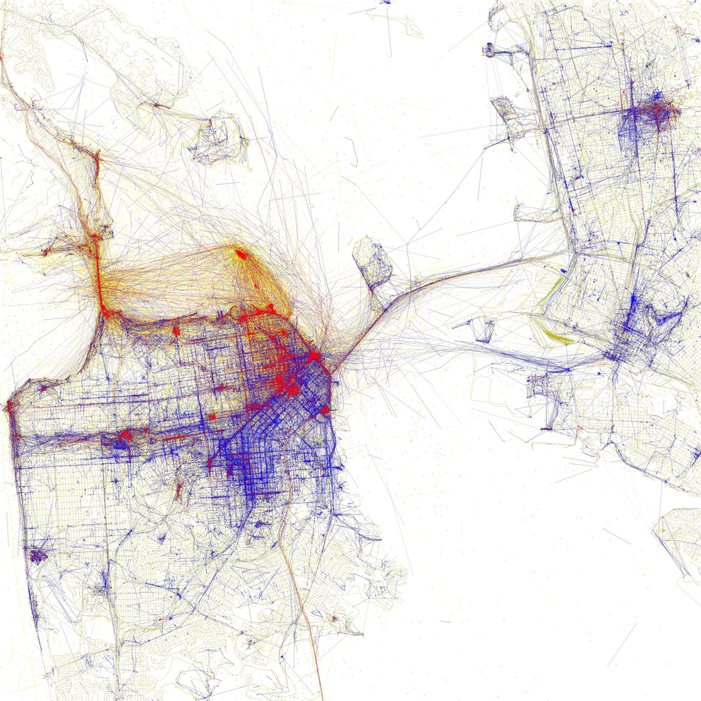
Eric Fischer’s visual representation of pictures taken in San Francisco by tourists and locals
A visual representation of where pictures are taken in San Francisco as tourists and locals.
Source: Eric Fischer (flickr)
Looks nice, doesn’t it? Data artist Eric Fischer also build a worldwide map of local allegiances with MapBox and Twitter. Some of his visualisations are exhibited at the MoMa, utilising the Flickr and Picasa API (like the image of San Francisco above), showing locals and tourists in metropolitan areas around the world. Berlin is among them as well.
Related
API data Eric Fischer map mapbox San Francisco visualisation
mprecke
March 31, 2015
Urbanity
0

Copyright © 2023 Moritz Philip Recke. All Rights Reserved.


