Tag:map
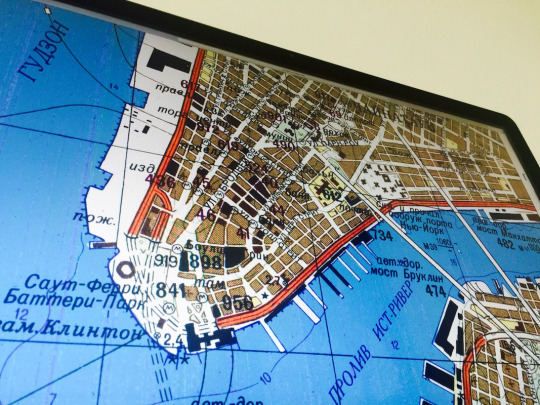
Inside the Secret World of Russia’s Cold War Mapmakers
“The maps were part of one of the most ambitious cartographic enterprises ever undertaken. During the Cold War, the Soviet military mapped the entire world, parts of it down to the level of individual buildings. The Soviet maps of US and European cities have details that aren’t on domestic maps made around the same time, things like the precise width of roads, the load-bearing capacity of bridges, and the types of factories.”
Source: “Inside the Secret World of Russia’s Cold War Mapmakers” – wired.com
A nice story about Russell Guy’s acquisition of soviet maps in 1989, John Davie’s attempts to piece together how they were made and some other interesting tales… Also, a book by John Davies & Alexander J Kent about Soviet military mapping will be published in 2016. So, if you are interested, get on the waiting list.
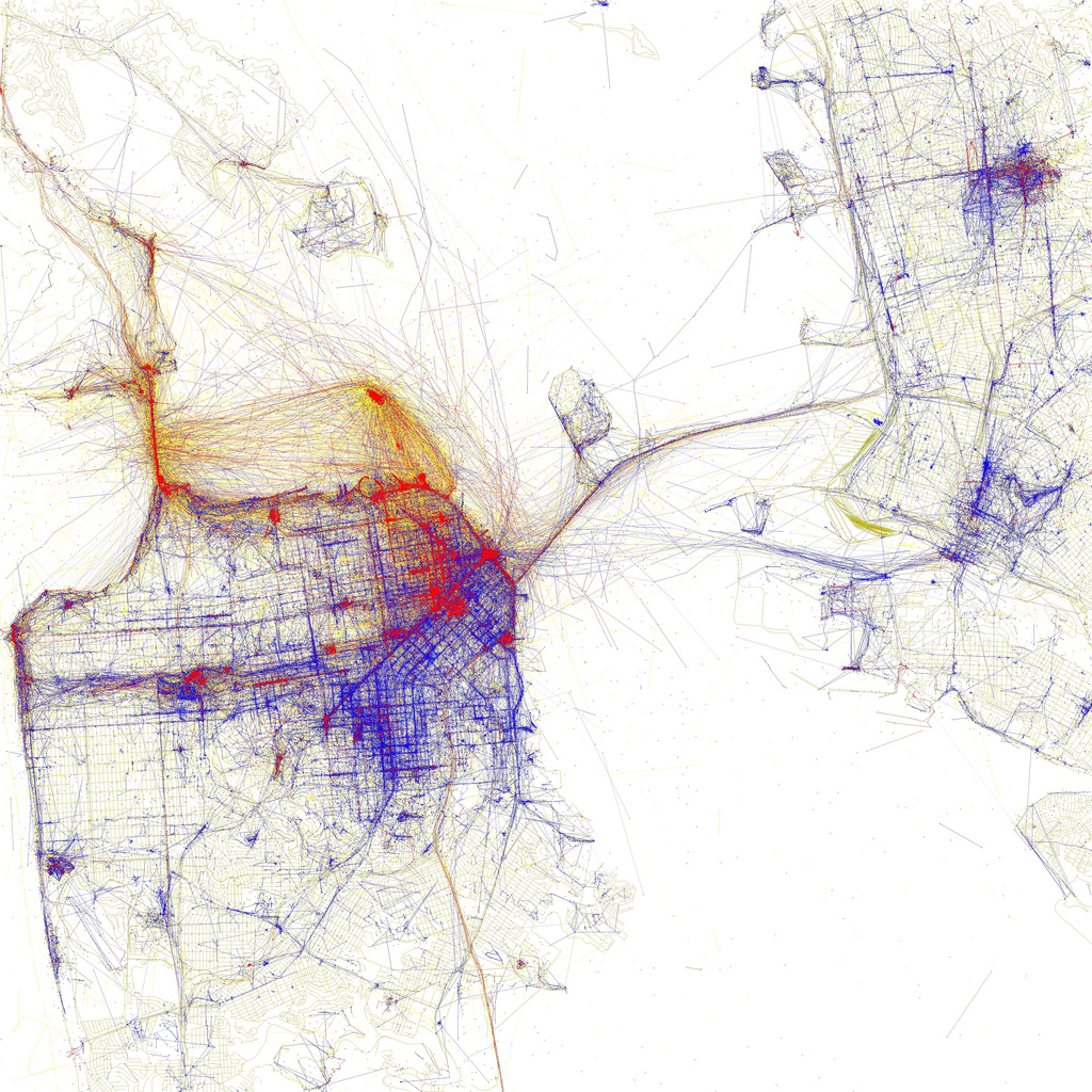
A visual representation of where pictures are taken in San Francisco as tourists and locals. Source: Eric Fischer (flickr) Looks nice, doesn’t it? Data artist Eric Fischer also build a worldwide map of local allegiances with MapBox and Twitter. Some of his visualisations are exhibited at the MoMa, utilising the Flickr and Picasa API (like the image of San Francisco above), showing locals and tourists in metropolitan areas around the world. Berlin is among them as well.
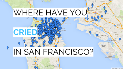
San-Francisco: When you tell your story to others you provide also the wisdom of your life to our human community. This digital storytelling collection by IDEO team member Ann-Marie Alcantaratakes place in San Francisco/ Bay Area. “Where have you cried in San Francisco?”. Actually, real deep. PS: The last story will kill you. (1m notes = megadeath)